
Valle del Sol topographic map
Interactive map
Click on the map to display elevation.
About this map
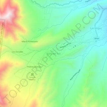
Name: Valle del Sol topographic map, elevation, terrain.
Average elevation: 2,069 m
Minimum elevation: 1,815 m
Maximum elevation: 2,545 m
Other topographic maps
Click on a map to view its topography, its elevation and its terrain.
Parque Provincial Cordón Del Plata
Argentina > Mendoza > Valle del Sol > Villa El Portezuelo
Parque Provincial Cordón Del Plata, Francisco Guiñazú, Villa El Portezuelo, Valle del Sol, Distrito Potrerillos, Departamento Luján de Cuyo, Mendoza, Argentina
Average elevation: 3,023 m