
De Klinge topographic map
Interactive map
Click on the map to display elevation.
De Klinge
De Klinge ligt aan de Belgisch-Nederlandse grens. Men vindt er de bossen van Zandig Vlaanderen, zoals het Stropersbos, en ook Scheldepolders met kreken zoals het Saleghem Krekengebied. De hoogte loopt op tot 5 meter. De Klinge wordt gerekend tot het Waasland.
About this map
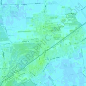
Name: De Klinge topographic map, elevation, terrain.
Average elevation: 3 m
Minimum elevation: -2 m
Maximum elevation: 8 m
Other topographic maps
Click on a map to view its topography, its elevation and its terrain.
Kwakkel
België > Oost-Vlaanderen > Sint-Niklaas > Sint-Gillis-Waas > Sint-Pauwels
Average elevation: 6 m