
Itocta topographic map
Interactive map
Click on the map to display elevation.
About this map
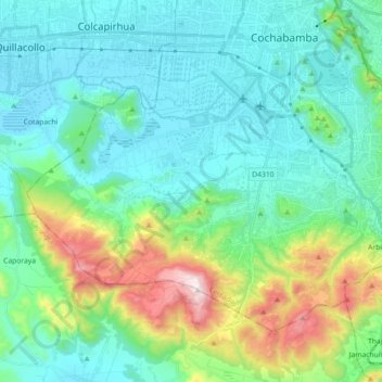
Name: Itocta topographic map, elevation, terrain.
Location: Itocta, Cochabamba, Cercado, Cochabamba, Bolivia (-17.52579 -66.27834 -17.39968 -66.09877)
Average elevation: 2,704 m
Minimum elevation: 2,535 m
Maximum elevation: 3,311 m
Other topographic maps
Click on a map to view its topography, its elevation and its terrain.