
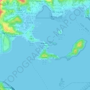
Sam Mun Tsai topographic map
Interactive map
Click on the map to display elevation.
About this map
Name: Sam Mun Tsai topographic map, elevation, terrain.
Average elevation: 9 m
Minimum elevation: -3 m
Maximum elevation: 143 m
Other topographic maps
Click on a map to view its topography, its elevation and its terrain.
Yim Tin Tsai
China > Hong Kong > Tai Po District > Shuen Wan Lei Uk > Sam Mun Tsai New Village
Yim Tin Tsai, Sam Mun Tsai New Village, Shuen Wan Lei Uk, Tai Po District, New Territories, Hong Kong, China
Average elevation: 3 m