
Yolçatı topographic map
Interactive map
Click on the map to display elevation.
About this map
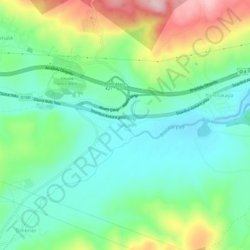
Name: Yolçatı topographic map, elevation, terrain.
Location: Yolçatı, Bolu, Black Sea Region, 14030, Turkey (40.69574 31.45792 40.73574 31.49792)
Average elevation: 855 m
Minimum elevation: 774 m
Maximum elevation: 1,028 m
Other topographic maps
Click on a map to view its topography, its elevation and its terrain.