
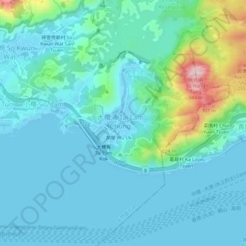
Luen On San Tsuen topographic map
Interactive map
Click on the map to display elevation.
About this map
Name: Luen On San Tsuen topographic map, elevation, terrain.
Average elevation: 54 m
Minimum elevation: -2 m
Maximum elevation: 324 m
Other topographic maps
Click on a map to view its topography, its elevation and its terrain.
Luen On San Tsuen
China > Hong Kong > Tuen Mun District > Tai Lam Chung Village
Luen On San Tsuen, Tai Lam Chung Village, Tuen Mun District, New Territories, Hong Kong, China
Average elevation: 54 m