
Thank you for supporting this site ❤️
Make a donation
Make a donation
Huaibei topographic map
Click on the map to display elevation.
Thank you for supporting this site ❤️
Make a donation
Make a donation
About this map
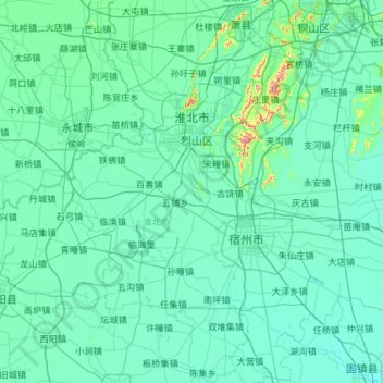
Name: Huaibei topographic map, elevation, terrain.
Location: Huaibei, Anhui, China (33.28130 116.38837 34.24982 117.04676)
Average elevation: 35 m
Minimum elevation: 16 m
Maximum elevation: 368 m
Thank you for supporting this site ❤️
Make a donation
Make a donation
Other topographic maps
Click on a map to view its topography, its elevation and its terrain.