
Río de la Plata topographic map
Interactive map
Click on the map to display elevation.
About this map
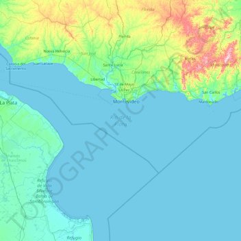
Name: Río de la Plata topographic map, elevation, terrain.
Location: Río de la Plata, C1426COA, Uruguay (-36.34966 -58.54521 -33.91623 -54.94109)
Average elevation: 36 m
Minimum elevation: -2 m
Maximum elevation: 464 m
Other topographic maps
Click on a map to view its topography, its elevation and its terrain.