
Thank you for supporting this site ❤️
Make a donation
Make a donation
Wittem topographic map
Click on the map to display elevation.
Thank you for supporting this site ❤️
Make a donation
Make a donation
About this map
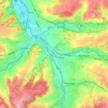
Name: Wittem topographic map, elevation, terrain.
Location: Wittem, Gulpen-Wittem, Limburg, Netherlands (50.79802 5.89814 50.82406 5.98352)
Average elevation: 138 m
Minimum elevation: 79 m
Maximum elevation: 212 m
Thank you for supporting this site ❤️
Make a donation
Make a donation
Other topographic maps
Click on a map to view its topography, its elevation and its terrain.