
Thank you for supporting this site ❤️
Make a donation
Make a donation
Steinhöring topographic map
Click on the map to display elevation.
Thank you for supporting this site ❤️
Make a donation
Make a donation
About this map
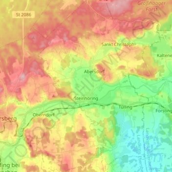
Name: Steinhöring topographic map, elevation, terrain.
Location: Steinhöring, Landkreis Ebersberg, Bavaria, 85643, Germany (48.04842 11.99216 48.13828 12.08788)
Average elevation: 543 m
Minimum elevation: 468 m
Maximum elevation: 621 m
Thank you for supporting this site ❤️
Make a donation
Make a donation
Other topographic maps
Click on a map to view its topography, its elevation and its terrain.
Thank you for supporting this site ❤️
Make a donation
Make a donation
Hesselfurt
Germany > Bavaria > Landkreis Ebersberg > Grafing > Grafing-Bahnhof
Average elevation: 541 m