
Thank you for supporting this site ❤️
Make a donation
Make a donation
Wilderness topographic map
Click on the map to display elevation.
Thank you for supporting this site ❤️
Make a donation
Make a donation
About this map
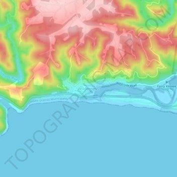
Name: Wilderness topographic map, elevation, terrain.
Location: Wilderness, George, Western Cape, 6560, South Africa (-34.01324 22.55863 -33.97324 22.59863)
Average elevation: 69 m
Minimum elevation: -3 m
Maximum elevation: 212 m
Thank you for supporting this site ❤️
Make a donation
Make a donation
Other topographic maps
Click on a map to view its topography, its elevation and its terrain.