
Thank you for supporting this site ❤️
Make a donation
Make a donation
Dongguan topographic map
Click on the map to display elevation.
Thank you for supporting this site ❤️
Make a donation
Make a donation
About this map
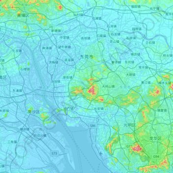
Name: Dongguan topographic map, elevation, terrain.
Location: Dongguan, Guangdong Province, China (22.65648 113.51648 23.14484 114.25528)
Average elevation: 24 m
Minimum elevation: -12 m
Maximum elevation: 553 m
Thank you for supporting this site ❤️
Make a donation
Make a donation
Other topographic maps
Click on a map to view its topography, its elevation and its terrain.