
Thank you for supporting this site ❤️
Make a donation
Make a donation
Plattling topographic map
Click on the map to display elevation.
Thank you for supporting this site ❤️
Make a donation
Make a donation
About this map
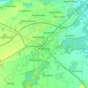
Name: Plattling topographic map, elevation, terrain.
Location: Plattling, Landkreis Deggendorf, Bavaria, 94447, Germany (48.75282 12.84104 48.81069 12.96910)
Average elevation: 322 m
Minimum elevation: 311 m
Maximum elevation: 344 m
Thank you for supporting this site ❤️
Make a donation
Make a donation
Other topographic maps
Click on a map to view its topography, its elevation and its terrain.