
Thank you for supporting this site ❤️
Make a donation
Make a donation
Hochstaufen topographic map
Click on the map to display elevation.
Thank you for supporting this site ❤️
Make a donation
Make a donation
Hochstaufen
At an altitude of 1,750 m is the Reichenhaller Haus, an alpine hut of the Deutscher Alpenverein (Section Bad Reichenhall).
Thank you for supporting this site ❤️
Make a donation
Make a donation
About this map
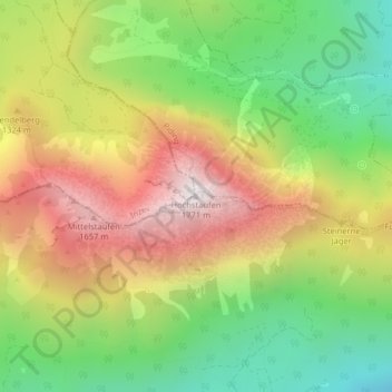
Name: Hochstaufen topographic map, elevation, terrain.
Average elevation: 1,115 m
Minimum elevation: 582 m
Maximum elevation: 1,732 m
Thank you for supporting this site ❤️
Make a donation
Make a donation