
Buôn Ma Thuột topographic map
Interactive map
Click on the map to display elevation.
About this map
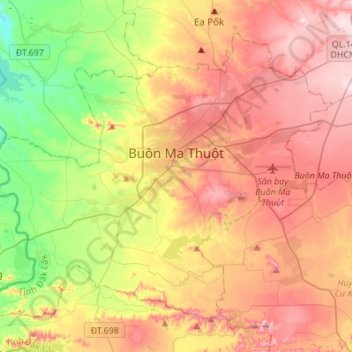
Name: Buôn Ma Thuột topographic map, elevation, terrain.
Location: Buôn Ma Thuột, Đắk Lắk Province, Vietnam (12.55301 107.89207 12.76956 108.16588)
Average elevation: 442 m
Minimum elevation: 236 m
Maximum elevation: 645 m
Other topographic maps
Click on a map to view its topography, its elevation and its terrain.