
Thank you for supporting this site ❤️
Make a donation
Make a donation
Prichsenstadt topographic map
Click on the map to display elevation.
Thank you for supporting this site ❤️
Make a donation
Make a donation
About this map
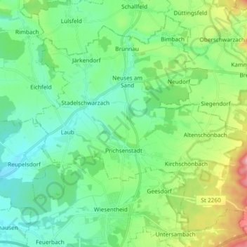
Name: Prichsenstadt topographic map, elevation, terrain.
Location: Prichsenstadt, Landkreis Kitzingen, Bavaria, 97357, Germany (49.78680 10.29707 49.86992 10.44376)
Average elevation: 266 m
Minimum elevation: 206 m
Maximum elevation: 442 m
Thank you for supporting this site ❤️
Make a donation
Make a donation
Other topographic maps
Click on a map to view its topography, its elevation and its terrain.