
Thank you for supporting this site ❤️
Make a donation
Make a donation
Sumaré topographic map
Click on the map to display elevation.
Thank you for supporting this site ❤️
Make a donation
Make a donation
Sumaré
Sumaré is a city in the State of São Paulo, Brazil. It is part of the Metropolitan Region of Campinas. The population is 286,211 (2020 est.) in an area of 153.47 km2. The elevation is 583 m. Sumaré was founded in 1868, after being upgraded to a city. Its old name was Rebouças,The municipality is formed by the headquarters and the district of Nova Veneza. Japanese car manufacturer Honda has a plant at the city from 1997 to 2021.
Thank you for supporting this site ❤️
Make a donation
Make a donation
About this map
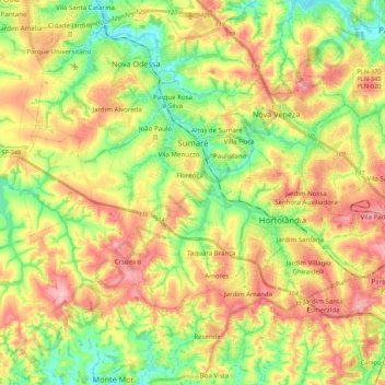
Name: Sumaré topographic map, elevation, terrain.
Average elevation: 595 m
Minimum elevation: 532 m
Maximum elevation: 665 m
Thank you for supporting this site ❤️
Make a donation
Make a donation
Other topographic maps
Click on a map to view its topography, its elevation and its terrain.