
Kütükçü Ali Bey Parkı topographic map
Interactive map
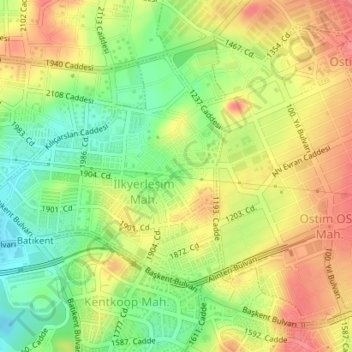
Click on the map to display elevation.
About this map
Name: Kütükçü Ali Bey Parkı topographic map, elevation, terrain.
Average elevation: 863 m
Minimum elevation: 825 m
Maximum elevation: 897 m
Other topographic maps
Click on a map to view its topography, its elevation and its terrain.
Gaziantep
The plan introduced several important changes to the city's transportation network. One of the most important was the addition of a rail line to connect Gaziantep to the national rail system. Up to now, Turkish railway construction had ignored Gaziantep (partly because of its mountainous surroundings); a…
Average elevation: 880 m
Ayder
Ayder at 40°57′N 41°05′E / 40.950°N 41.083°E / 40.950; 41.083 is a typical yayla with no settled population; it hosts visitors during summers. The average altitude is 1,350 metres (4,430 ft). It is a part of Çamlıhemşin District of Rize Province. The distance to Çamlıhemşin is 17…
Average elevation: 1,683 m
Niksar
Niksar is approximately 9,555 km2 (3,689 sq mi). It is located at 40°35' north latitude and 36°58' east longitude. Its average altitude is 350m above sea level. It is surrounded by Erbaa on the northwest, Tokat on the southwest, Almus on the south, Başçiftlik on the southeast and Akkuş on the north. It is…
Average elevation: 1,009 m
Adıyaman
Adıyaman has a hot summer Mediterranean climate (Csa) under both the Köppen and Trewartha classifications, with some continental characteristics. Summers are very hot and very dry. Temperatures often reach 40 °C (104 °F) at the height of summer. The highest recorded temperature was 45.3 °C (113.5 °F) on…
Average elevation: 814 m