
Dörtyol topographic map
Interactive map
Click on the map to display elevation.
About this map
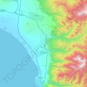
Name: Dörtyol topographic map, elevation, terrain.
Location: Dörtyol, Hatay, Mediterranean Region, Turkey (36.78392 36.12054 36.94726 36.46149)
Average elevation: 726 m
Minimum elevation: 0 m
Maximum elevation: 2,217 m
Other topographic maps
Click on a map to view its topography, its elevation and its terrain.