
Thank you for supporting this site ❤️
Make a donation
Make a donation
Boghé topographic map
Click on the map to display elevation.
Thank you for supporting this site ❤️
Make a donation
Make a donation
About this map
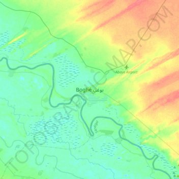
Name: Boghé topographic map, elevation, terrain.
Location: Boghé, Brakna, Mauritanie (16.43578 -14.41960 16.75578 -14.09960)
Average elevation: 18 m
Minimum elevation: 3 m
Maximum elevation: 49 m
Thank you for supporting this site ❤️
Make a donation
Make a donation