
Ben Nevis topographic map
Interactive map
Click on the map to display elevation.
About this map
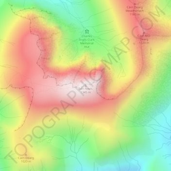
Name: Ben Nevis topographic map, elevation, terrain.
Location: Ben Nevis, Highland, Scotland, United Kingdom (56.79681 -5.00358 56.79691 -5.00348)
Average elevation: 912 m
Minimum elevation: 474 m
Maximum elevation: 1,338 m
Other topographic maps
Click on a map to view its topography, its elevation and its terrain.
Tornagrain
United Kingdom > Scotland > Highland
Tornagrain, Highland, Scotland, IV2 8AL, United Kingdom
Average elevation: 51 m
Cawdor
United Kingdom > Scotland > Highland
Cawdor, Highland, Scotland, IV12 5BL, United Kingdom
Average elevation: 77 m
Glencoe
United Kingdom > Scotland > Highland
Glencoe, Highland, Scotland, PH49 4HS, United Kingdom
Average elevation: 114 m