
Sandersdorf-Brehna topographic map
Interactive map
Click on the map to display elevation.
About this map
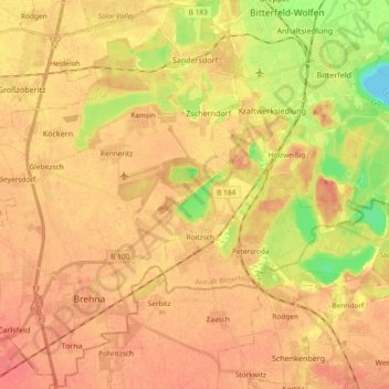
Name: Sandersdorf-Brehna topographic map, elevation, terrain.
Location: Sandersdorf-Brehna, Anhalt-Bitterfeld, Saxony-Anhalt, Germany (51.53106 12.15737 51.64517 12.34375)
Average elevation: 90 m
Minimum elevation: 56 m
Maximum elevation: 106 m