
Sütçüler Mahallesi topographic map
Interactive map
Click on the map to display elevation.
About this map
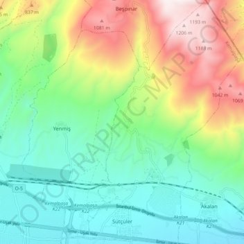
Name: Sütçüler Mahallesi topographic map, elevation, terrain.
Location: Sütçüler Mahallesi, Kemalpaşa, Izmir, Aegean Region, Turkey (38.45232 27.43434 38.52160 27.49424)
Average elevation: 507 m
Minimum elevation: 136 m
Maximum elevation: 1,248 m