
Multān District topographic map
Interactive map
Click on the map to display elevation.
About this map
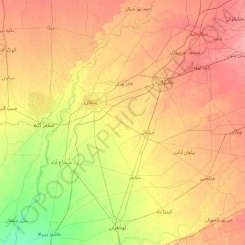
Name: Multān District topographic map, elevation, terrain.
Location: Multān District, Punjab, Pakistan (29.44333 71.02667 30.72333 72.30667)
Average elevation: 129 m
Minimum elevation: 103 m
Maximum elevation: 156 m
Other topographic maps
Click on a map to view its topography, its elevation and its terrain.