
Famagusta topographic map
Click on the map to display elevation.
About this map
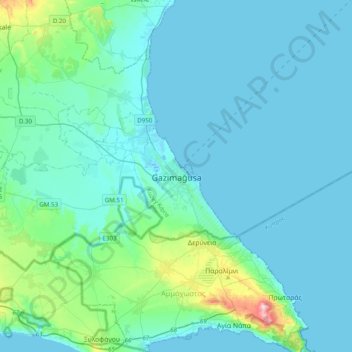
Name: Famagusta topographic map, elevation, terrain.
Location: Famagusta, Gazimağusa District, 99540, Cyprus (34.96454 33.77254 35.28454 34.09254)
Average elevation: 19 m
Minimum elevation: -1 m
Maximum elevation: 175 m
Other topographic maps
Click on a map to view its topography, its elevation and its terrain.