
Thank you for supporting this site ❤️
Make a donation
Make a donation
Zone IV topographic map
Click on the map to display elevation.
Thank you for supporting this site ❤️
Make a donation
Make a donation
About this map
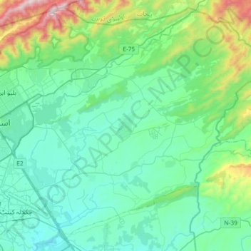
Name: Zone IV topographic map, elevation, terrain.
Location: Zone IV, Islamabad Capital Territory, Pakistan (33.58138 73.08761 33.79905 73.37488)
Average elevation: 647 m
Minimum elevation: 432 m
Maximum elevation: 1,585 m
Thank you for supporting this site ❤️
Make a donation
Make a donation