
Thank you for supporting this site ❤️
Make a donation
Make a donation
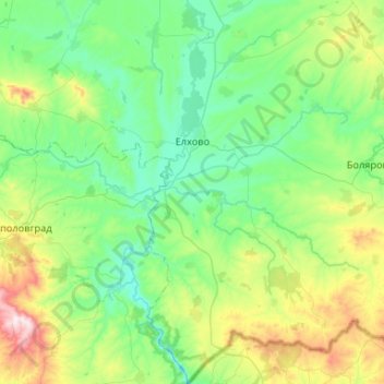
Elhovo topographic map
Click on the map to display elevation.
Thank you for supporting this site ❤️
Make a donation
Make a donation
Elhovo
Central to this region is the field of Elhovo. Its flat surface extends on both sides of the river Tundzha which is flowing from the north. The average elevation is 100–150 m. In the peripheral parts the field gradually passes into the gentle slopes of the Manastira and the Dervent Heights.
Thank you for supporting this site ❤️
Make a donation
Make a donation
About this map
Name: Elhovo topographic map, elevation, terrain.
Location: Elhovo, Yambol, Bulgaria (41.92596 26.37183 42.31558 26.80146)
Average elevation: 235 m
Minimum elevation: 60 m
Maximum elevation: 852 m
Thank you for supporting this site ❤️
Make a donation
Make a donation
Other topographic maps
Click on a map to view its topography, its elevation and its terrain.