Phú Giáo District topographic map
Interactive map
Click on the map to display elevation.
About this map
![Phú Giáo District topographic map, elevation, terrain](/pub/maps/relation/8fmt/gdgf4s/thumbnail.jpg)
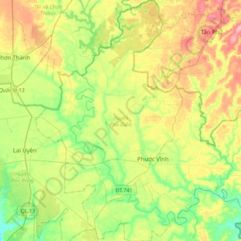
Name: Phú Giáo District topographic map, elevation, terrain.
Location: Phú Giáo District, Bình Dương Province, Vietnam (11.18835 106.64371 11.49196 106.95321)
Average elevation: 55 m
Minimum elevation: 9 m
Maximum elevation: 124 m
Other topographic maps
Click on a map to view its topography, its elevation and its terrain.
![Dầu Tiếng District topographic map, elevation, terrain](/pub/maps/relation/9xtf/wfw3b3/icon.jpg)
Dầu Tiếng District
Dầu Tiếng District, Bình Dương Province, Vietnam
Average elevation: 31 m